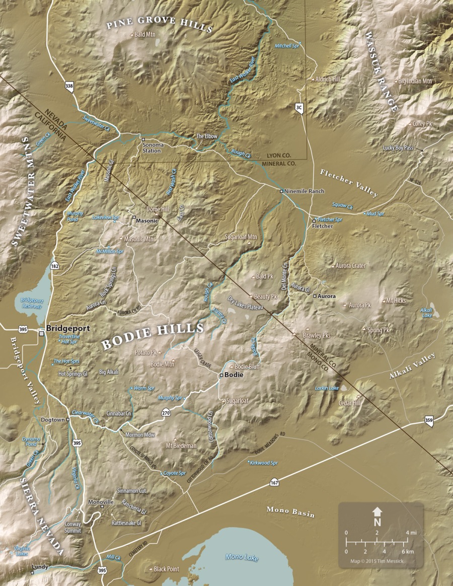
Map-making is a big part of my day-job (at ICF International in Sacramento). I’ve loved detailed maps since I was a kid, especially maps of wild places in the mountains and deserts of California and elsewhere. So naturally, I want to make a nice map of the Bodie Hills. Several others exist already (see links below), but I want to make my own for this book on the plants. Here’s a current (March 2015) draft of the map, and below are some notes on how it was made.
This map was built in Adobe Illustrator, with help from Adobe Photoshop and two great cartographic plug-ins: MAPublisher for Illustrator, and Geographic Imager for Photoshop, both from Avenza Systems in Toronto.
The shaded relief background was created using digital elevation models (DEMs) from the The National Map. DEMs are a special image format wherein darker pixels represent lower elevations and lighter pixels represent higher elevations. Geographic Imager enables Photoshop to interpret this as a shaded relief image with the light source set to any angle and elevation. Geographic Imager also lets you create custom color gradients to help distinguish low, middle, and high elevations within the map area.
The roads, water features, and boundaries on the map were added using georeferenced vector data (shape files and KMZs) downloaded from various on-line sources of GIS data. Some of this was organized and edited in Google Earth Pro. These data and the georeferenced shaded relief image were all brought together using MAPublisher, which turns Illustrator into a very functional and designer-friendly Geographic Information System — a really nice tool for cartography. The labels were all added in Illustrator, which gives you complete control over the appearance of text and other artwork.
I mentioned there are some other good maps of the Bodie Hills, and here they are:
1) The Bodie Hills Map (by Tom Harrison Maps)
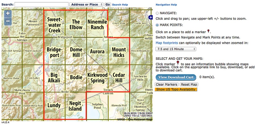
2) The US Geological Survey 7.5-minute topographic quadrangles for the Bodie Hills are (in the red outline with bolded names):
These can be downloaded for free from the USGS Map Store Map Locator & Downloader page. This is a great resource, but it’s a little complicated. On the Locator Map (see the screenshot above), zoom in to the area north of Mono Lake, select the “Mark Points” mode, click on a quadrangle to make a red pin appear, then click on the pin to get a list of available maps. Scroll through the list (which is in descending chronological order), and click on the file size in the “Download” column to start downloading a PDF of the selected map. The newest maps are very recent. The oldest are less detailed and cover larger areas, but are more than a century old—interesting to compare with today’s roads, towns, and place names.


