It’s past time for an update to the vascular plant checklist for Hot Springs Valley and Grover Hot Springs State Park, in Alpine County, California. Since the last version of the checklist (November 2018), several plants have been added to the list, based on observations posted to iNaturalist (https://www.inaturalist.org/observations?place_id=127882). The list now includes 348 “minimum rank” taxa (distinct species, subspecies, or varieties) in 64 plant families. The March 2024 version of this checklist (a free 8-page PDF) is available on the Downloads Page.
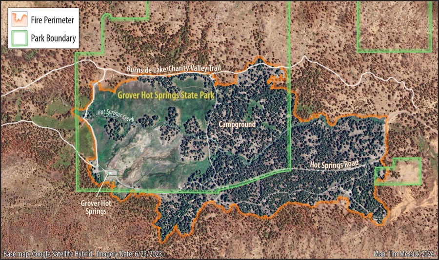
Some of these additions are a result of disturbance and habitat changes caused by the Tamarack Fire, which burned much of the valley (but not the hot springs, meadows, or campground) in July 2021. Below are two views of the Tamarack Fire perimeter. The first shows the burned area in relation to all of Hot Springs Valley, including Grover Hot Springs State Park; the second is zoomed in to the fire perimeter around the meadows within the main part of the park.

Recent additions to the list of plants here include:
- Argemone munita (Flatbud Prickly Poppy)
- Eriogonum umbellatum (Sulfur Buckwheat)
- Heterotheca orovillosa (Hairy Goldenaster)
- Mimetanthe pilosa (False Monkeyflower)
- Nicotiana attenuata (Coyote Tobacco)
- Ranunculus alismifolius Plantainleaf Buttercup)
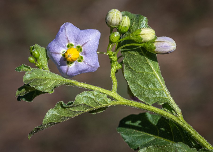
- Solanum xanti (Purple Nightshade)
It will be interesting to continue exploring burned areas and monitoring habitat recovery this year and for some years to come. I was impressed with the abundance of native flora growing in some burned areas (especially near moisture) during my last visit, in June 2023.

Data source for California Fire Perimeters (updated annually): https://gis.data.ca.gov/datasets/CALFIRE-Forestry::california-fire-perimeters-all-1/explore
Copyright © Tim Messick 2024. All rights reserved.
