Tag Archives: Geology

Strolling around Panum Crater

Panum Crater in Google Earth

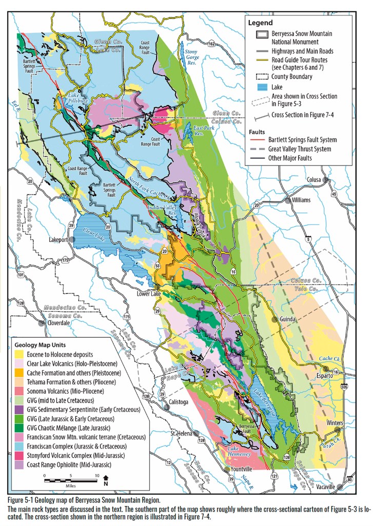
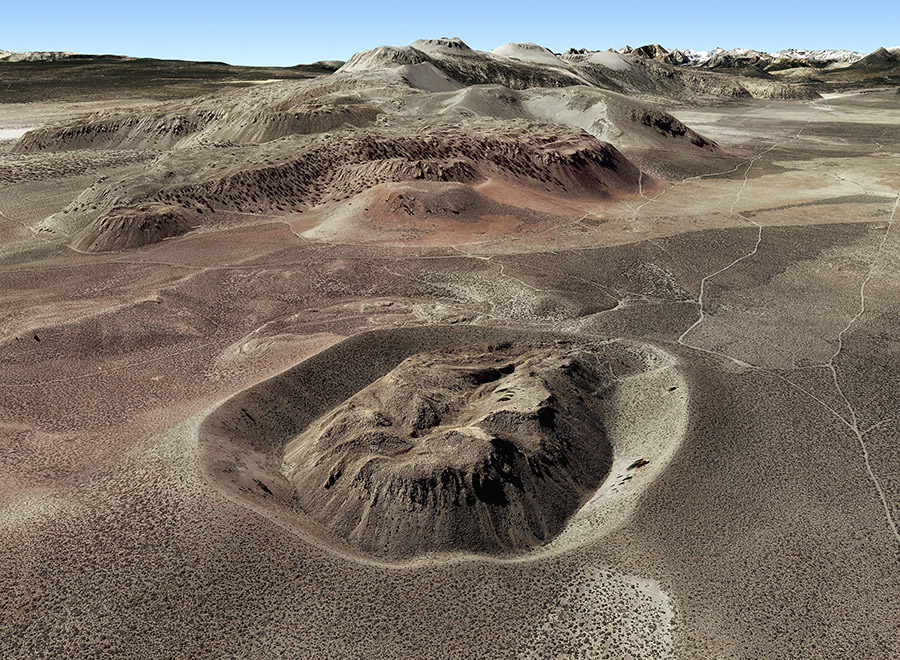
Panum Crater (foreground) and Mono Craters as seen in
Google Earth, looking southeast.

Panum Crater

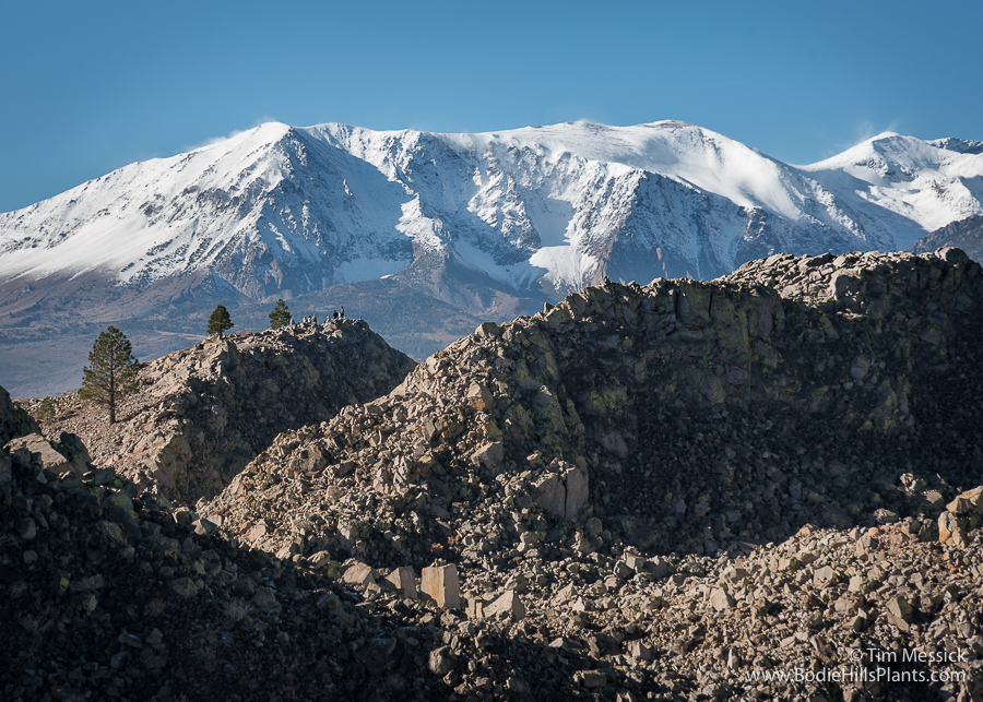
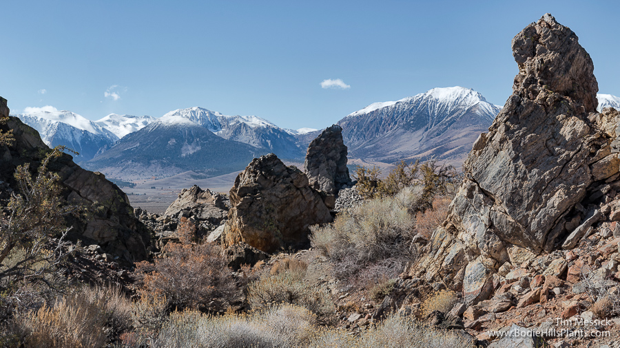
One frosty morning in late October I walked around the narrow rim of Panum Crater, just south of Mono Lake. This is the youngest volcanic feature in the Mono Basin, so if you love landscapes built by fire and carved by ice, I highly recommend this hike, but do it in cool weather or very early on a summer day.

Panum Crater

Panum Crater

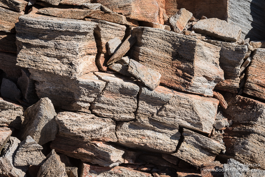
Panum Crater is only about 670 ±20 years old (circa 1320s to 1360s AD) (Sieh and Bursik 1986). The initial eruption was of the “Plinian” type, where abundant gases escape from the rising magma, producing a massive plume and rain of volcanic ash that may continue for weeks. (This is the same type of eruption that occurred on a larger scale at Italy’s Mt. Vesuvius in 79 AD, burying Pompeii and Herculaneum—witnessed and later described by Pliny the Younger, hence the name “Plinian.”) After the plumes of gas and ash subsided, magma welled up within Panum Crater to form a jagged dome of obsidian and pumice. Some time after the Panum Crater event, more ash fell throughout the area from eruptions several miles farther south in the Inyo Craters area.

Panum Crater

What would it have been like to see, hear, and smell this eruption, to feel the earth shake before and during the eruption? There were certainly Native Americans living here at that time — in the Mono Basin, the Bodie Hills, Bridgeport and Adobe Valleys, and on down to Owens Valley. We don’t know what time of year the eruption occurred, but there could have been groups traveling over Mono Pass and along other routes to trade with neighboring tribes when the eruption began.

Panum Crater

Laylander (1998) speculated on how earlier (ca. 880 AD) and larger Plinian eruptions in the Mono Craters may have affected local witnesses: “Local consequences for human populations from the eruption can be imagined. The event may have directly caused some loss of life or frightened the surviving witnesses into leaving the Mono Basin. The decimation of plant and animal communities may have drastically reduced the resource value of the affected area for humans for some time.” (He goes on to consider whether “an occupational hiatus, followed by a return to pre-event conditions” could be detected in the archaeological record and whether the duration of this hiatus could be estimated archaeologically. He concludes that “a hiatus of as much as a century is not likely to be detectable in the archaeological record” using hydration dating of artifacts, unless the sample size is “very large.”)

Panum Crater

Panum Crater

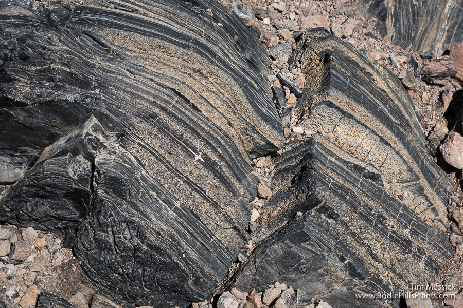
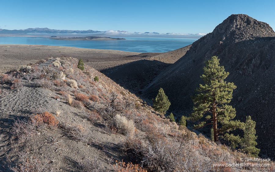
Banded obsidian and pumice atop the dome.

Panum Crater

Panum Crater

Panum Crater

Panum Crater is not quite the youngest cinder cone in California — that distinction may belong to Cinder Cone in Lassen Volcanic National Park, which erupted about 300 years later, circa 1650. And Lassen Peak itself erupted last in 1915.

References:
Laylander, D. 1998, Cultural Hiatus and Chronological Resolution: Simulating the Mono Craters Eruption of ca. A.D. 880 in the Archaeological Record, Proceedings of the Society for California Archaeology 11:148-154.

Sieh, K. and M. Bursik 1986. Most recent eruption of the Mono Craters, eastern central California. Journal of Geophysical Research, 91(B12): 12,539–12,571.


Copyright © Tim Messick 2020. All rights reserved.
DOWNLOAD THE CHECKLIST

Effects of the Earthquake near Bodie

I was in Bodie the first week it was open to the public since the magnitude 5.7 earthquakes near Nine Mile Ranch in Fletcher Valley that caused some damage here and startled people through much of the Eastern Sierra region on December 28, 2016. There is visible damage to the walls or contents of several buildings. There’s also an issue with the water system.

Perhaps most serious is damage to the back wall of the DeChambeau Hotel. Some bricks fell away from the top of the wall and other cracks are visible lower in the wall.

DeChambeau Hotel

Brick Wall


Inside the DeChambeau Hotel, bottles on the bar fell over.

Bar

Next door in the IOOF building, many of the old bottles that were neatly stacked in a display case fell to the floor and broke.

Bottles


In the morgue, an open coffin toppled off the back of the table on which it was resting. The lid came off another one standing to its left.

Morgue

May 2017

Morgue, 2007

October 2007


The Boone Store lost one of the large front windows, now temporarily covered with plywood. Inside, the hat-wearing dress form looks a little worse for her exposure to the elements.

Boone Store

Boone Store

May 2017

Boone Store

June 2013


In the Cain House, bottles toppled from the display shelves inside the front windows.


Over on the northeast side of the Bodie Hills, in Fletcher Valley, the stone walls the historic building at Nine Mile Ranch (the oldest intact building in Mineral County!) were severely damaged. This building is only a mile from the epicenters of the largest quakes.

Nine Mile Nine Mile


Copyright © Tim Messick 2017. All rights reserved.
DOWNLOAD THE CHECKLIST

Another Swarm of Quakes

Late last December, three moderate earthquakes hit Fletcher Valley and rattled much of the eastern Sierra Nevada. An historic stone building at Ninemile Ranch was seriously damaged, and brick walls all around Bodie were tested for their strength. Every day since that event, very small aftershocks have continued to jiggle the valley east of the Bodie Hills.

2017-04-14 Fletcher quakes map

This week, another concentrated swarm of very small quakes (magnitude 0.1 to 2.6) has appeared under Alkali Valley, about 10 miles southeast of the Fletcher Valley epicenters, just east of Mt. Hicks, at the eastern corner of the Bodie Hills. The aftershocks have been tapering off in Fletcher Valley (only 28 in the last 7 days), but Alkali Valley has felt 120 tremors in just the last 2 days. The maps above and below are from the US Geological Survey’s “Latest Earthquakes” web map of the area (to which I’ve added some place names).

2017-04-14 Fletcher quakes context

Will Alkali Valley experience a stronger event soon—one that people in the area could actually feel? Maybe not. We’ll see. The region east of Mono Lake and the Bodie Hills is part of a seismically active region along the west edge of the Great Basin, known as the Walker Lane. Just 4 miles north of the Alkali Valley tremors is the most recent volcanic feature adjacent to the Bodie Hills—the late Pleistocene (less than 100,000 years old) trachyandesite lava dome of Mud Spring. Earlier in the Pleistocene, Lake Russel (the much larger ancestral Mono Lake) actually overflowed northward from what is now Alkali Valley, into Fletcher Valley and the East Walker River. Volcanism and uplift in the Mount Hicks area eventually raised the outlet higher than the fluctuating lake level, and a different spillway developed later, southeastward into Adobe Valley.

This is an actively evolving terrain, even on a human timescale. That’s just one of the reasons I love the Great Basin and eastern Sierra Nevada landscape.

UPDATE a week later: 204 quakes in the Alkali Valley area during the last 7 days. The strongest, magnitude 3.1.


Copyright © Tim Messick 2017. All rights reserved.
DOWNLOAD THE CHECKLIST